Martinho will bring heavy rain, wind and rough seas
Today’s apparent lull in the torrential rain, wind and cold of March will be making way for more bad weather, warns national emergency and civil protection authority ANEPC.
The latest depression, dubbed Martinho, will bring with it heavy rainfall, wind and rough seas.
In a statement today, ANEPC said that IPMA (Portuguese Institute for Sea and Atmosphere) predicts, “precipitation, sometimes heavy and persistent, which may be hail and accompanied by thunderstorms, especially in the central and southern coastal regions” and “strong winds, with gusts of up to 75 km/h across most of the territory, which may reach 120 km/h in the highlands”.
In addition to “conditions favorable to the occurrence of extreme wind phenomena, especially in the Central and Southern regions”, forecasts point to “strong sea agitation south of Cabo Mondego” and “snowfall at the highest points of Serra da Estrela”.
According to information from Portuguese Environment Agency APA, Civil Protection warns of potential flooding in the Tejo basin during the next 48-hours. Areas most vulnerable were named as Cascais, Oeiras, Lisbon, Loures, Odivelas and Setúbal.
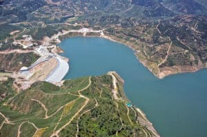
In the Sado basin, the “possibility of an increase in the tributary flows to dams” is predicted and “flows in the Sado river may increase”; in the Guadiana basin, “inflows to Monte Novo may increase” and “an increase in flows in the Guadiana river may occur”, while in the Algarve river basin (Sotavento) “an increase in flows may occur”. (All this at a time when dams are having controlled discharges…)
“This meteorological situation is expected to be more serious from the (tomorrow) afternoon to the morning of March 20th”, says ANEPC, with “the occurrence of flooding in urban areas, caused by the accumulation of rainwater due to obstruction of drainage systems and/ or coastal overtopping” and “flooding, increased by the overflow of the bed of some watercourses, rivers and streams”.
ANEPC’s note also refers to “the instability of hillsides (…) leading to mass movements (landslides, collapses and others) caused by water infiltration, a phenomenon that can be exacerbated by the removal of vegetation cover following rural fires, or by artificial soil development”, as well as “slippery road surfaces due to the possible formation of water sheets” and “possible accidents on the coastline, due to strong sea waves”.
And there is the warning of the possibility of “loose objects being swept onto roads, and/ or mobile or poorly fixed structures becoming detached, due to episodes of strong winds”, threatening to cause accidents involving vehicles in circulation and/ or people on public roads.
As if all this is not enough to batten down the hatches and hunker under a pillow, ANEPC also highlights “thermal discomfort for the population due to the increased intensity of the wind”.
What to do?! ANEPC encourages “the adoption of appropriate measures (…) particularly in historically more vulnerable areas, namely through unblocking rainwater drainage systems (…) securing loose structures, particularly scaffolding, placards and other suspended structures” (…) and taking “special care when moving around or staying close to wooded areas” or “near the coastline and riverside areas”.
All in all, people are advised to ‘lie low’, take it slow – and trust that good weather will (one day) return to smile on us if we haven’t already been blown or swept away.
Source material: LUSA