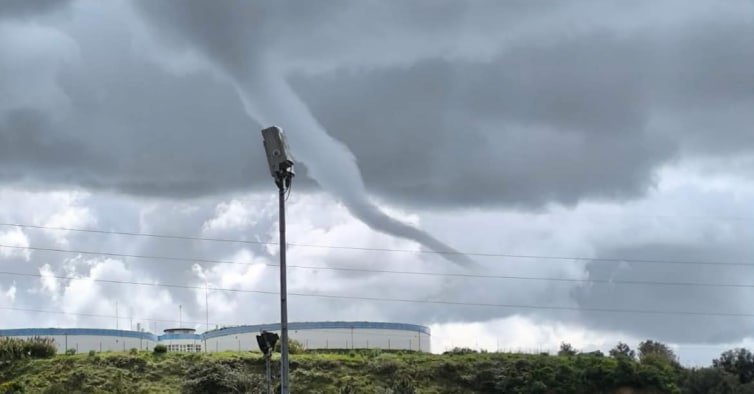
Funnel-cloud was ‘initial phase of tornado’ but did not touch ground
With so much rain, wind and cold dragging us all through March, people in Santarém were taken by surprise on Saturday when they saw what they thought looked like a tornado whirling above the region.
A quick exchange of information with Meteo Trás-os-Montes Facebook page brought the information that it was in fact a ‘funnel cloud’, which is the initial phase of a tornado, that only becomes a tornado if it makes contact with the ground.
This funnel cloud didn’t. But it was recorded over Almeirim, Cartaxo, Glória do Ribatejo and Caséval.
Also known as a ‘condensation cloud’, these atmospheric phenomena extend from a cumuliform cloud, and usually occur when there are rotational winds inside a cloud, which creates an atmospheric circulation that goes down towards the ground.
In this case, the funnel cloud appears to have blown itself out. Not so the bad weather. Meteo Trás-os-Montes warns this week could see the country getting more rain than during any other week so far this winter: “The maps show that a lot of water will fall (this) week, possibly one of the wettest Marches on record, and just what we need! The week will be marked by the passage of storm #Laurence, which will bring us a bit of everything, rain, thunderstorms, snow, wind, cold”, says the forecasting page, adding that the winter has still quite a bit more in store for everyone. ND