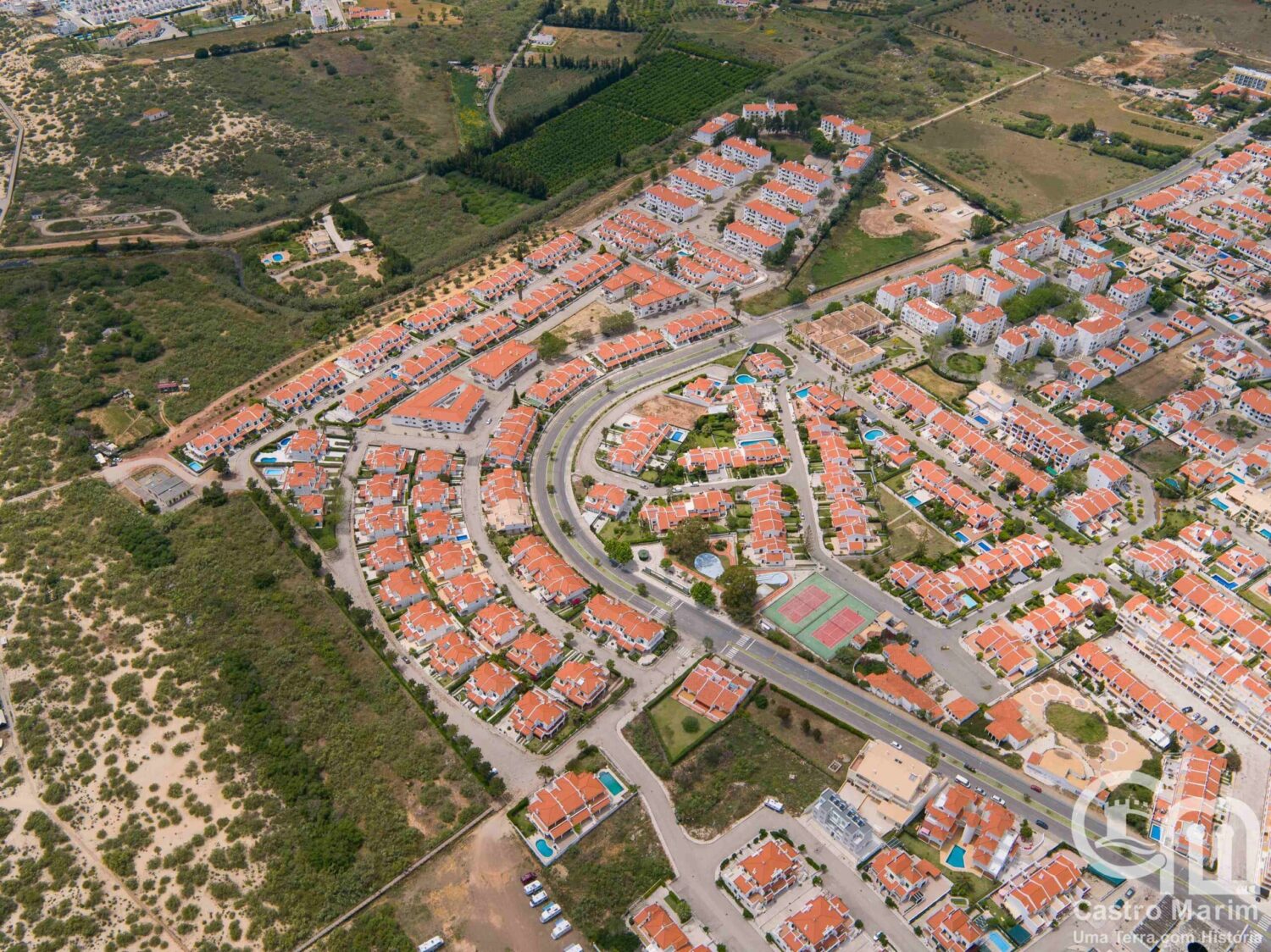
Decades of “unchecked urban expansion” now have to be corrected, the local council says
The municipal council of Castro Marim is launching a wave of critical infrastructure projects aimed at preventing and mitigating the impact of floods in vulnerable coastal and riverside zones – particularly the village of Altura and the banks of Ribeira do Álamo.
In a statement to the press, the local council says it is responding to decades of “unchecked urban expansion” in the 70s, 80s, and 90s that left the area exposed. The widespread paving over of natural land and the construction of drainage-blocking structures are now being addressed through comprehensive studies and targeted engineering.
A key part of the strategy stems from detailed hydraulic analyses carried out for the years 2024 and 2025, which model rainfall patterns and water flow scenarios for extreme weather events with return periods of 10, 20, 50, and even 100 years – taking into account maximum high tides. The results are now being translated into real-world action and new major projects
The focus is on carrying out projects and improvements that tackle the recurring floods along Altura’s seafront, particularly at older developments “whose network of infrastructures did not take rainwater drainage into account.”
Projects are set to launch that will install a new public stormwater network, redefine drainage plans, and ultimately reduce flood risk for residents and businesses.
These works are also part of Castro Marim’s broader Municipal Climate Action Plan, which recently completed a phase of public consultation. The plan includes guidance for both public and private developments in flood-prone zones and aims to correct or adapt to the consequences of past urbanisation, especially in Altura’s low-lying western areas and the historic village of Castro Marim itself.
Flood control isn’t new to the town, however. Past projects include the construction of a submarine emissary system to drain stormwater from southern Altura into the open sea, and a network of six underground drainage channels built alongside Avenida 24 de Junho. Water from northern housing developments is already being channelled directly to Ribeira do Álamo.
Still, the municipality acknowledges that even with ongoing maintenance and monitoring, climate change is making the challenge more complex.
Next up are several new interventions, including one partially led by private developers. Among the most significant is the installation of a new pipeline collector, set to begin in 2025, which will improve stormwater routing throughout Altura.
Also in the pipeline is the major public works contract for the “Stormwater Collector for Drainage Basin B4 in Altura’s Western Zone”, designed to direct runoff into the Ribeira do Álamo. In parallel, plans are underway for a new retention lagoon in the Verdelago area, doubling the current capacity to hold and discharge rainwater via the existing emissary.
With these efforts, the municipal council says it is committed to improving one of the Algarve’s main coastal areas, “minimising problems created by human action” which it attributes to “a lack of studies and forecasts of nature, we believe.” Still, the council admits that bouts of unpredictable weather and natural phenomena are becoming “more frequent, unpredictable and unstable.”