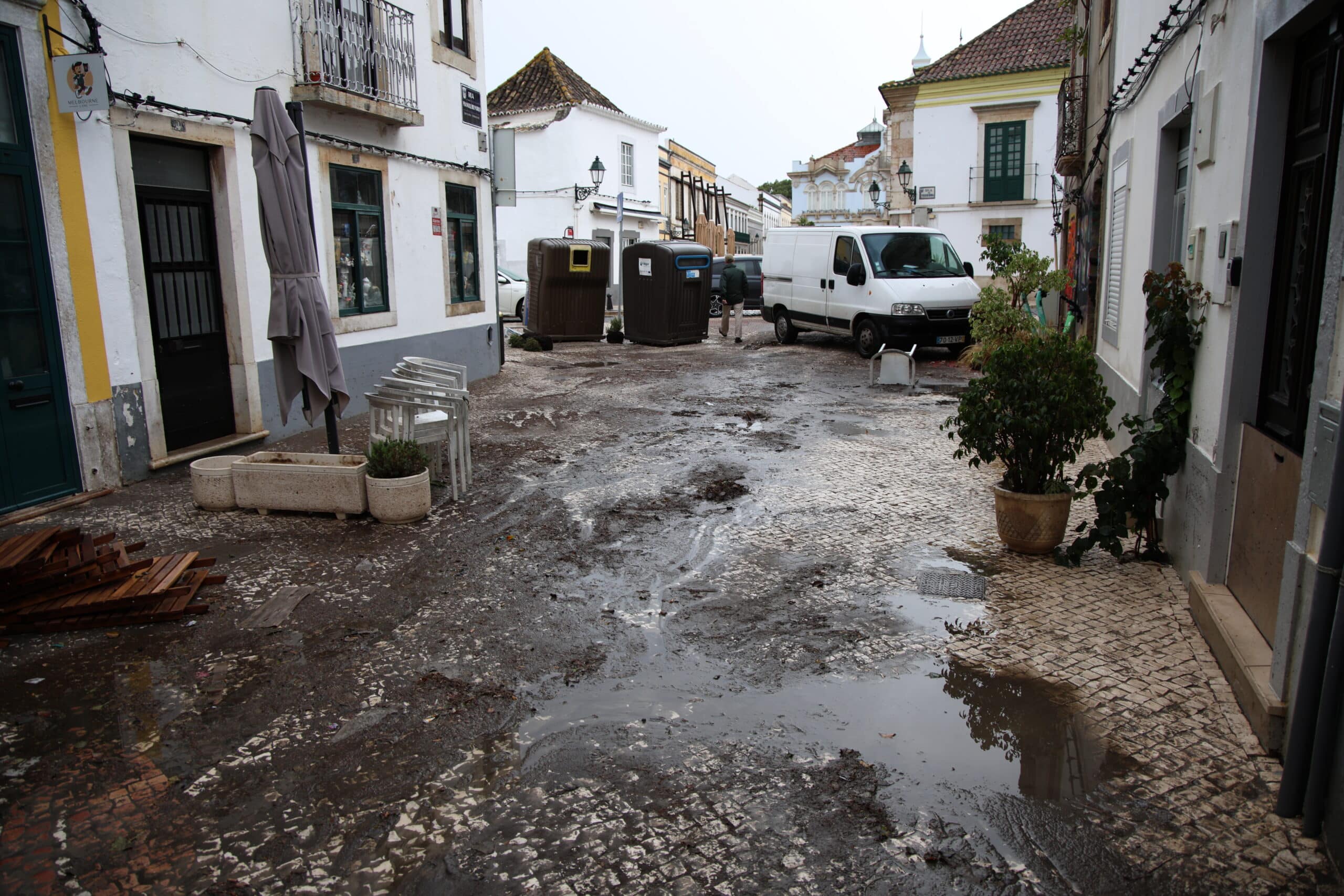
The municipal council of Faro has launched a major plan to tackle urban flooding, identifying 16 risk zones that require “urgent action”.
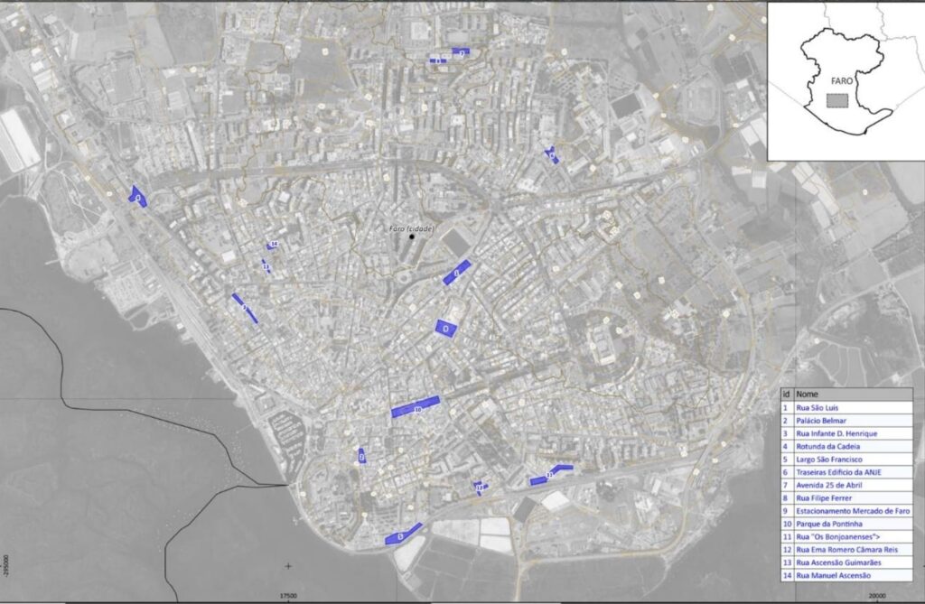
The initiative began with a technical visit of the risk zones on Friday, November 8, led by deputy mayor Valentina Calixto, accompanied by Professor Poças Martins, described as a “specialist in the matter,” as well as members of municipal company FAGAR and the Portuguese Environment Agency (APA). The team inspected 16 flood-prone zones, all identified as requiring immediate intervention.
A map pinpointing the worst-affected locations includes Rua de São Luís and Avenida 25 de Abril, which historically can become flooded in a matter of minutes after it starts raining heavily, as well as Rua Infante D. Henrique, Rua Filipe Ferrer, Rua Ema Romero Câmara Reis, and the Pontinha and Faro Municipal Market car parks.
The works, which are due to take place in the next two months, will focus on rolling out short-term fixes to reduce and eventually eliminate flooding incidents.
Authorities also pinpointed areas where old, combined drainage networks – which mix wastewater and rainwater – are still in use, causing pollution in the Ria Formosa estuary, as well as odour problems and pest infestations in nearby neighbourhoods.
The plan is to phase the works, addressing the most urgent flooding hotspots first while gradually introducing a separate drainage system across the city.
To fund the interventions, the council will apply for EU and Environmental Fund financing.
“The goal is to strengthen the municipal budget, create better conditions to carry out the works and address one of the main problems affecting the town of Faro,” the council said in a statement.