The 2025 Atlantic hurricane season officially began on June 1 and will end on November 30. After a slow start, there has recently been back-to-back tropical cyclones expected to whip up the Atlantic Ocean and produce dangerous waves.
But it is not only waves that we should be concerned about. The second issue is how the close passing or a direct hit on the mainland would have been if we were experiencing active wildfires at the time, as was the case in October 2017.
Gabrielle hit the Azores as a Hurricane Category 1, causing nearly 200 occurrences, but soon lost strength, eventually arriving on the mainland as a post-tropical cyclone. By this time, the wind speeds had decreased considerably, but still on September 27, there was a wind gust of almost 100 km/h recorded.
A week earlier, the fire in Aljezur was burning with intensity, to the point where the fire commander stated “that it had reached a level at which it was out of control and beyond the capacity of resources, both on the ground and in the air, to extinguish”. This begs the question: what would have been the effect if the tropical cyclone had arrived a week earlier and had not lost its intensity?
What may be on the way?
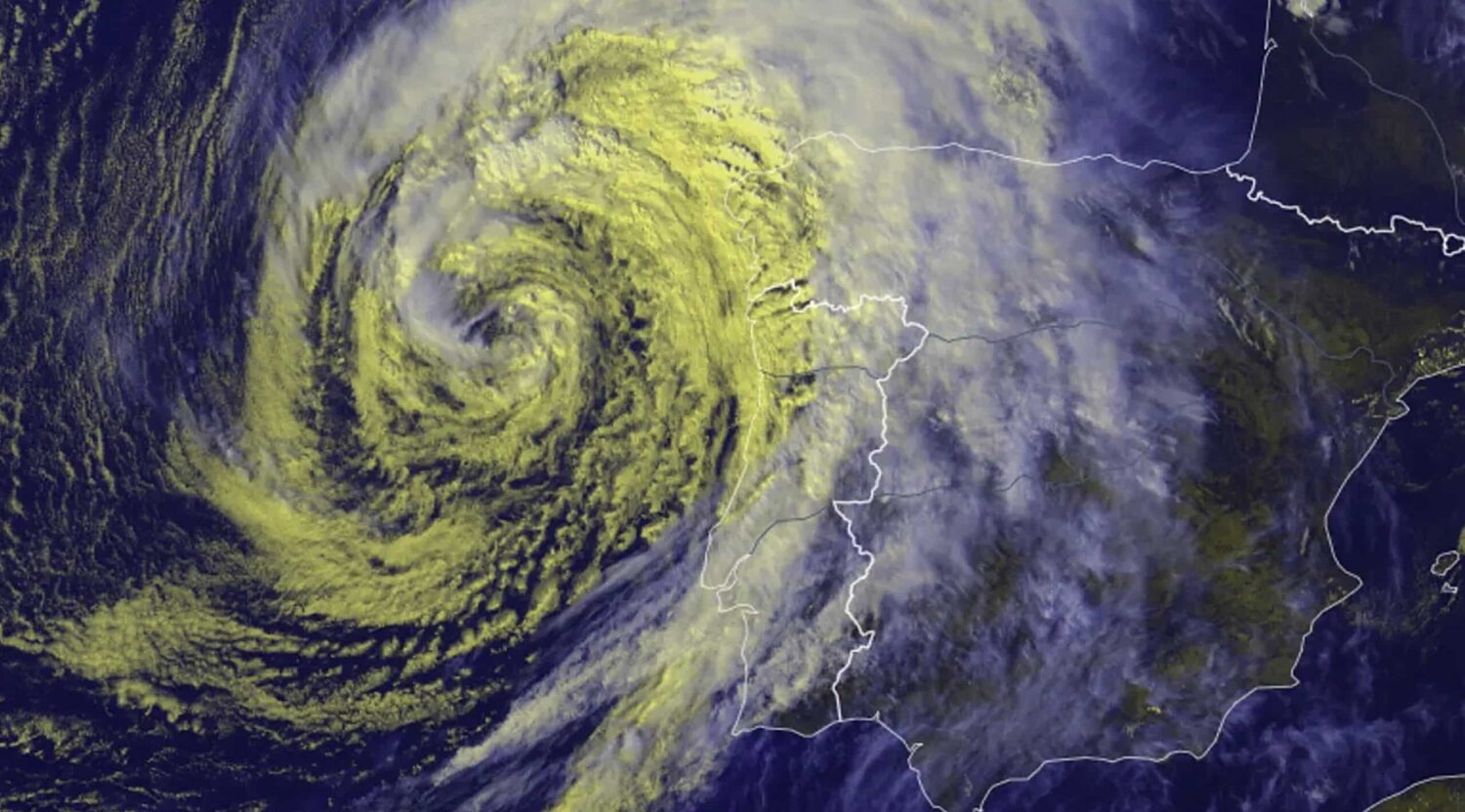
On the other side of the Atlantic, Hurricane Humberto has intensified to a Category 5 hurricane. This has become the second consecutive season to feature more than one Category 5 hurricane, with 2024 having Beryl and Milton.
Hurricane Humberto, now a top-strength Category 5 hurricane, and Tropical Storm Imelda are expected to move initially north before taking on a more northeasterly direction.
On Sunday, the National Hurricane Center said Humberto surpassed the minimum threshold for Category 5 – sustained winds of at least 252 km/h – and gusting higher than this. “Humberto will likely remain a powerful major hurricane for the next several days,” the US Hurricane Center said.
Noting Humberto’s graduation to major status, Philip Klotzbach, Colorado State University meteorologist and hurricane expert, said: “For the first time since 1935, the Atlantic’s first three hurricanes have all been major: Erin, Gabrielle, and Humberto.” The question, of course, is, will Humberto move in the general direction of the Azores or take a slightly west northwesterly trajectory as is the current forecast?
It is important to note that the fire risk and Fire Weather Index (FWI) are currently far lower than at the same time in 2017. Should Humberto or other tropical cyclones reach the Portuguese mainland with the current fire risk and FWI prevailing, it would be extremely unlikely to have an impact anywhere near that of Ophelia in October 2017.
The effects of Hurricane Ophelia on the October 2017 wildfires
It is now widely recognized that, although not landing on the Iberian Peninsula, Hurricane Ophelia caused widespread impacts in the region, being one of the catalysers of the October 2017 Iberian wildfires, together with dryness of the vegetation.
Hurricane Ophelia fitted within the context of an apparent increase in tropical cyclone activity in the north-eastern part of the North Atlantic basin, including (at the time) four events, all producing impacts in either continental Portugal (Ophelia in 2017, Leslie in 2018, and Alpha in 2020) or in the archipelago of Azores (Lorenzo in 2019). Hurricane Ophelia in October 2017 and Hurricane Leslie in 2018 affected the Iberian Peninsula with important socio-economic impacts.
Ophelia’s track passed around 400 kilometres west off the coast of mainland Portugal heading northwards as a Category 1 hurricane with an intensity of 155 km/h, being one of the few tropical cyclones that affected the Iberian Peninsula since 1851.
Hurricane Ophelia had its origin in the first week of October, farther north of typical cyclogenesis areas for most tropical cyclones in the North Atlantic basin, where it stayed relatively stationary for about two days, gathering intensity over the warm waters, due to the presence of a mid-latitude ridge located north.
On October 12, the ridge erosion helped to induce the gradual movement of Ophelia eastward while it intensified into its maximum intensity of 185 km/h (south of Azores), corresponding to a Category 3 on the Saffir-Simpson Hurricane Wind Scale.
On October 15, Hurricane Ophelia was sufficiently close to the Portuguese coastal region to foster the transport of a warm and dry air mass, but it was still located too far from continental Portugal to put the territory under the direct influence of the moist tropical air associated with the cyclone’s core and outer bands, which could provide some relief from severe fire weather conditions.
The unusual presence of Hurricane Ophelia, as well as its very specific positioning, were determinant to produce the exceptional meteorological conditions observed at the date of the fires (i.e., very high temperatures, very low relative humidity, and strong surface wind).
The storm winds from Hurricane Ophelia induced a very strong southerly wind that blew hot and dry air from North Africa over a major part of the territory, increasing fire danger during October 14, and especially October 15.
In Coimbra, the FWI reached an all-time record value of 82, making it impossible to control fires that escaped the initial attack. On October 17, there was precipitation in most of the country, decreasing the fire danger and helping to control most fires on October 18.
However, by that time, it was too late, and people had tragically died. In other words, Ophelia, as it approached, had helped in increasing the fire intensity, but subsequently, through its rainfall, had helped firefighters suppress the fires.
Critical fire events burning in extreme fire danger conditions, such as those described in this report, can only be extinguished when the weather conditions improve and fire danger decreases.
“Preparedness” is the key word
We are now at the start of the hydrological year from October 1, a time traditionally of greater rainfall replenishing the reservoirs. We need to be prepared, for example, for floods, enhanced by the overflow of the bed of some watercourses, rivers and streams, slope instability leading to landslides and increased road accidents. We can do this by taking action to safeguard our property and taking extra care when driving.