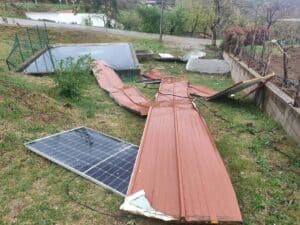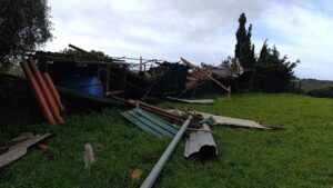
Weather in mainland Portugal will continue to be affected by heavy and persistent rainfall, particularly on Tuesday and Wednesday, due to a mass of air with tropical characteristics.
Meteorologist Ângela Lourenço has been telling SIC: “The weather in mainland Portugal will continue to be affected by a disturbed westerly current, which means that from today onwards we will be influenced by a mass of air with tropical characteristics, with a high water content. It is a very humid mass of air that will bring persistent rainfall, at least in the first part of the week, at least until the 11th (Wednesday).”
“For the 10th (Tuesday), orange level rainfall warnings have already been issued for Viana do Castelo, Braga, Porto, Vila Real, Aveiro and Viseu. A more critical period is expected there, with significant accumulated rainfall, hence the orange level rainfall warning,” she said.
According to Ângela Lourenço, on Tuesday the rain is expected to be lighter in Baixo Alentejo and Algarve.
“These episodes of more intense rainfall, particularly on the 11th, may be accompanied by wind. The 10th is not expected to have very strong winds, but in any case, these situations always bring stronger gusts in the highlands,” she said.
Ângela Lourenço added that from Thursday onwards, a slight improvement is expected.
“But in any case, precipitation will continue to occur, and the wind will continue to blow with some intensity. Over the weekend, precipitation may slow. The shift of the anticyclone further north will allow us to be less affected by these frontal waves and air masses with high water content,” she said, stressing that there is still a low degree of confidence in this scenario.
As for temperatures, according to Ângela Lourenço, they will be above normal for this time of year.
“Precisely because this tropical air mass, with tropical characteristics, predominates, temperatures tend to rise. We are talking about minimum temperatures around Lisbon of around 14/15 and maximum temperatures of 17/18 degrees. Inland, in colder areas, minimum temperatures of between 4 and 6 degrees and maximum temperatures of 9/12 degrees are forecast for Serra da Estrela,” she said.
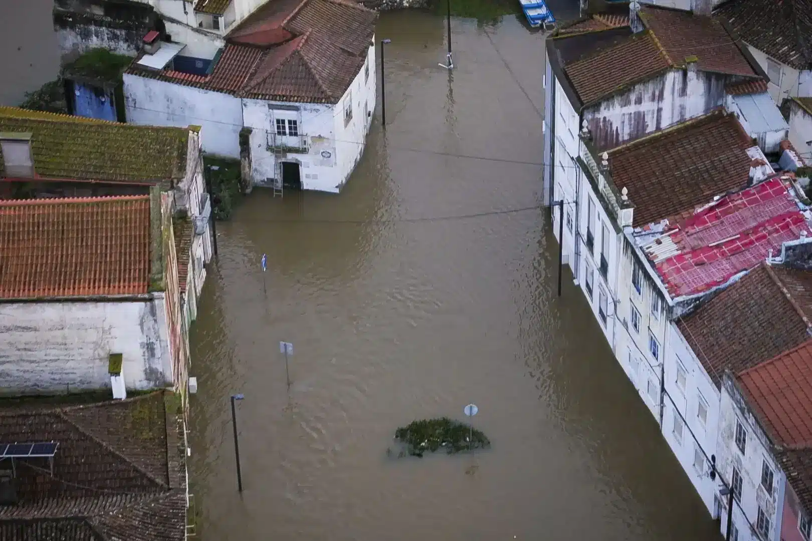
Meanwhile, the constant rainfall means there is still a risk of flooding in certain areas close to the Mondego, Tejo, Sorraia and Sado rivers – while the Vouga, Águeda, Lima, Cávado, Ave, Douro, Tâmega, Lis and Guadiana are all still causes for authorities’ concerns.
Elsewhere, climatologist Mário Lima has also been warning of a ‘new depression’ on the way: this time called Nils (or Niels) and described as an “atmospheric river” which will bring a lot more rain/ humidity, mainly to the areas of the centre and north of the country.
The Algarve, at long last, is looking as if by next weekend, the wet weather may finally be moving in a much better direction.