Tropical Cyclone Gabrielle could move towards the continent from Saturday afternoon, after passing through the Azores archipelago.
According to a statement from meteorological institute IPMA, based on the forecast provided by the ECMWF (European Central) model, which it uses for its forecasts, “this tropical cyclone will approach the Portuguese coast in the post-tropical depression category from the afternoon of September 27th”.
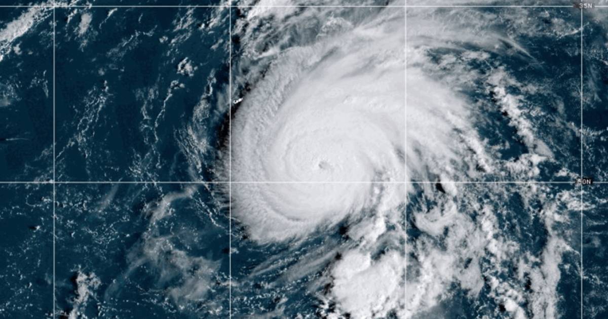
The cyclone is over the Atlantic today. In a statement, the Azores Meteorological Forecast and Surveillance Center of the IPMA (National Institute of Marine and Marine Sciences) reported that at 9:00 a.m. local time (10:00 a.m. in Lisbon), Gabrielle was “approximately 2,640 kilometers west-southwest of the Western Azores Group,” moving northeast.
According to data provided by the European Center’s model, periods of rain are expected from Saturday afternoon on the mainland “and an increase in wind intensity in the highlands and on the west coast, which will lead to increased sea agitation.”
“Given the geographic and temporal distance at which the cyclone is still located, some uncertainty remains regarding its trajectory and respective intensity,” adds IPMA, promising more information later today,
According to the Azores hurricane surveillance center, Gabrielle is currently classified as a Category 4 hurricane on the Saffir-Simpson scale (scale of 1 to 5, where 5 is the most severe category).
As it approaches the Azores archipelago, it is expected to lose intensity, hitting the region with tropical storm or Category 1 hurricane force winds,” said IPMA meteorologist Rita Mota.
The latest forecast update indicates that the center of the cyclone is expected to pass between the Western (Flores and Corvo) and Central (Terceira, Graciosa, São Jorge, Pico and Faial) groups on Friday.
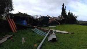
Thus, from Friday morning onwards, rain is expected on all islands, and it could be heavy in the Western and Central groups.
The wind is expected to intensify, with gusts ranging from 130 to 150 kilometers per hour (from the southwest, turning to the northwest).
As for sea agitation, it should also increase, with waves of eight to 10 meters of significant height and maximum height in the order of 14 to 18 meters (from southwest, passing to northwest), according to IPMA.
source: LUSA